Geschichte
Infos
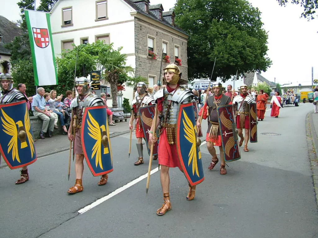
Vindriacum - Ein Dorf der Kelten
Agniatur? Orrorro ma ducidit istibus sum latem aut eos core vent ut elia sunt officipit laut eniae nimet exero es venihicias abor mod ut et doles ne mo ipsae por am adit etur, quia nobit, susdae eum adioreicipit offici blabo. Et et, unt pro ommodi aut eturem apedit veresequi alianto rempero dolendem. Nam deni bearibustia sae num aciis ut eum rem qui atis ipsa doluptat.
„Vindriacum“ nannten die Römer die keltische Siedlung mit dem Duft des Weines in der ersten Silbe ihres Namens. Orte mit der Endung „-ich“ (Wintrich) gehen auf das keltische „-iacum“ zurück – „Vindriacum“. Dies ist eine Bestätigung dafür, dass zu Beginn der Römerzeit die keltische Bevölkerung in Wintrich stark vertreten war. Diese These wird erhärtet durch die Tatsache, dass nicht nur der Ortsname keltischen Ursprungs ist, sondern dass noch viele Flurbezeichnungen -und andere- in der Gemarkung Wintrich auf die keltische Sprache zurückzuführen sind. Siedlungen, die erst zur Römerzeit entstanden sind, haben die römische Sprache als Ursprung -Neumagen = Noviagomagum- oder sie sind später auf fränkische Markmale zurückzuführen. Nehmen wir ein typisches Beispiel von mehreren statt „Wintrich“. „Zülpich“, eine Kleinstadt an der Römerstraße Trier – Köln gelegen, zwischen Düren und Euskirchen, wird zur Römerzeit „Tolbiacum“ genannt. Im Jahr 497 n. Chr. besiegte Chlodwig I. in der Schlacht bei Tolbiacum (Zülpich) die Alemannen, ließ sich taufen und legte damit den Grundstein für die Christianisierung der Franken.
Die Urbewohner unserer Heimat sind von fern her eingewandert, wahrscheinlich aus Kleinasien. Man nannte sie Ligurer, und sie sind die ersten unserer Vorfahren, von denen wir Kunde haben. Sie waren ein indogermanischer Völkerstamm unsteter Nomaden und ernährten sich fast ausschließlich von Jagd und Fischfang. Ihre Waffen bestanden aus Stein, kleinere Gebrauchsgegenstände wie Pfeilspitzen und Nadeln waren aus Tierknochen und die Kleidung aus Fellen. Gefäße wurden noch ohne Scheibe mit der Hand aus Lehm geformt. Erwähnt werden muss an dieser Stelle, dass auch auf dem Wintricher Berg Lehmgruben waren – „Lähmkaul“ –, die heute durch Flurbegradigungen verschwunden sind.
Der Übergang von der mittleren zur Jungsteinzeit ist in der Kulturentwicklung nur relativ spärlich belegt. Sie stützt sich z.T. lediglich auf Funde von Steingeräten. Funde aus der ausgehenden Jungsteinzeit stammen fast ausschließlich aus Gräbern, häufig aus Grabhügeln. Im Rückblick auf die Entwicklung der Jungsteinzeit spricht vieles für die Annahme, dass gegen Ende dieser Epoche eine wirtschaftlich gespannte Lage – evtl. bedingt durch stark angewachsene Bevölkerung und knapp werdendes Land in Gewässernähe – die die Menschen zur Ausweitung der Siedlungsräume zwang. Die jungsteinzeitlichen Kulturen siedelten nämlich nicht mehr ausschließlich nahe den Hauptgewässern auf besten Lößböden, sondern nahmen schon höhere Geländepartien ein. Womit wir wieder auf dem Wintricher Berg angelangt sind. Wasser war genügend vorhanden. Wer zählt die vielen Quellen, die vielen kleineren und größeren Bachläufe, die auf der Höhe der Wintricher Gemarkung entspringen. Die meisten dieser Quellen sind in den letzten Jahrzehnten der Zusammenlegung und der damit verbundenen Drainage zum Opfer gefallen. Dass auch bereits in dieser Zeit auf der Wintricher Höhe Ackerbau und Viehhaltung betrieben wurde, ist anzunehmen. Dieser Zeitepoche wird auch das Steinbeil, das Franz Fischer auf dem Wintricher Berg beim Pflügen entdeckte, zugeordnet.
Die Menschen der Jungsteinzeit besiedelten zunächst die flachen Hänge an Gewässern und lichteten die nähere Umgebung durch Abholzung und Brandrodung, um gleichermaßen Holz für den Hausbau und Freiflächen für die Beackerung und Viehhaltung zu gewinnen. Hochwasserfreie Hangkanten an Flussufern und Höhenrändern, wie zwischen Korbel und Bungert, waren bevorzugte Siedlungsareale der nacheiszeitlichen Jäger, Fischer und Sammler. Das zweite Viertel des letzten Jahrtausends v. Chr. ist durch die allgemeine Verwendung des Eisens gekennzeichnet. Die Eisenzeit erlebte in der Hunsrück- Eifel-Kultur einen starken Aufschwung mit deutlicher Bevölkerungszunahme und Erschließung auch der bergigen Gegenden. Charakteristisch für die Eisenzeit ist schon in der frühen Phase die Beisetzung der Toten vorwiegend in Brandgräbern unter Hügeln. Diese sind in Waldgebieten gelegentlich noch einzeln oder gruppenweise erhalten. Auch auf der Wintricher Gemarkung wurden im 20. Jahrhundert mehrere Gruppen solcher Hügelgräber entdeckt – siehe „Archäologische Funde in und um Wintrich“.
Die Kelten, ein indogermanisches Volk aus dem Donauraum, hatten sich inzwischen in Bewegung gesetzt. Sie erreichten in dieser Epoche den Mittelrhein und kamen mit den Ligurern in Berührung. Diese wichen zurück und verschwinden damit aus dem historischen Gesichtsbild. Die Kelten jedoch wiederum wurden von den aus Nordosten heranrückenden Germanen bedrängt und sie überschritten den Rhein. Im Gebiet von Hunsrück, Mosel und Eifel fanden sie für Jahrhunderte eine neue Heimat.
Obwohl die Germanen bereits im 1. Jahrhundert v. Chr. das rechte Rheinufer völlig besetzt hatten, konnten sich die Kelten auf der linken Rheinseite unter dem Schutz der Römer noch lange halten. Die Eroberungsfeldzüge der Römer leiten schließlich über von der urgeschichtlichen zur geschichtlichen Zeit.
Die Kelten teilten sich in verschiedene Volksstämme. In unserer Heimat – Hunsrück, Mosel, Eifel – war der Keltenstamm der „Treverer“ sesshaft geworden. Die Siedlung „Vindriacum“ lag, wie heute Wintrich, sehr geschützt vor Überfälle in dem durch eine hohe Bergwand moselaufwärts abgeriegelten Talkessel, erhöht über dem weiten Vorgelände der Marai (lat. mare, kelt. mor) und dem Brühl (kelt. brogilo = Sumpf, Wiese). Marai und Brühl waren weites, fruchtbares Wiesenland, das den Bauern mit dem Wiesen- und Ackerland auf dem Berge erlaubte, reichlich Kühe und Ochsen zu halten, alles selbst zu pflanzen und den Dünger für ihre Wingerte zu gewinnen. Walnussbäume wuchsen im Brühl, ein Wald von Obstbäumen im Bungert und in der Kurtel (Kurhoheit der Trierer Kurfürsten). Der älteste Ortsteil Thanischt (kelt. tanaoon) heißt heute noch im Dialekt Tonischt.
Die Gemarkung von Wintrich reicht stundenweit über den Berg. Das Marsfeld (röm. Kriegsgott Mars) ist weite fruchtbare Flur, dann folgen ausgedehnte Wälder. In ältester Zeit war der Eichenwald vorherrschend. Bei Kasholz (kelt. cas = Eichel) stand noch vor Jahren eine alte, dicke Eiche, die letzte von Generationen, am Waldrand. Auf der Flur im Tal findet sich noch der Name Kasbor (Bor = Quelle unter den Eichen).
Sicherlich war die heutige Ortslage von Wintrich zuerst besiedelt und aus den vorgenannten Gründen wurde auch das Hochplateau über Wintrich in die Siedlung mit einbezogen und entsprechende Verbindungswege geschaffen. Ein Verbindungsweg auf den Berg war sicher schon damals angelegt – auf der Trasse des alten Fuhrweges, vorbei am Büschel (kelt. Berg/Hügel) und an der Grauwies bis auf die Höhe, wo in größerem Umfang Ackerbau betrieben werden konnte. Erst mit dem Einzug der Römer in Vindriacum änderte sich die Siedlungsweise der hier lebenden keltischen Treverer.
So trägt heute noch das „Platt“ unseres Heimatortes die Spur jener ältesten Zeit, aus der es keine schriftlichen Aufzeichnungen gibt. Es sollte als etwas Unwiederbringliches gepflegt und nicht im Zuge der modernen Zeit abgeschliffen und vergessen werden.
Wenn man Neumagen -Noviagomagum- als Stützpunkt und Residenz der frühen Römerzeit bezeichnen kann, so muss man Wintrich sicher bis ins 2. Jahrhundert n. Chr. als „Keltisches Oppidum“ festlegen.
Man muss davon ausgehen, dass zuerst die Hauptrömerstraße Mainz – Bingen – Trier gebaut wurde. Nach oder während der Befestigung von Neumagen dann die Nebenstraße vom Weinplatz nach Neumagen, später von dieser Straße die Abzweigung über Kasholz, Wintricher Schutzhaus, Filzener Schutzhaus zur Liesermündung. Von dieser Nebenstrecke erfolgte dann wohl im 2. Jhdt. Die direkte Verbindung Windmühle – Neuweg – nach Wintrich. Die Wintricher Treverer hatten sicher noch gut 1 – 200 Jahre mehr Zeit, sich außerhalb des römischen Einflusses zu etablieren und keltische Kultur und Sprache zu festigen. 300 Jahre Römerherrschaft, 600 Jahre Frankenzeit und 800 Jahre Krummstab der Trierer Kurfürsten haben es nicht vermocht, in Vindriacum das Erbe der keltischen Sprache zu verdrängen.
Die Römer errichteten mehrere Gutshöfe aus massivem Mauerwerk und führten den Weinbau ein. Hierfür brauchten sie die Wintricher Kelten als kostengünstige Arbeiter, die sich dann vermehrt rund um die römischen Weingüter ansiedelten.
Es gibt mindestens drei Standorte, die für ein römisches Landgut in Frage kommen:
1. südlich des Friedhofs
2. auf der Stelle und in unmittelbaren Umgebung der Pfarrkirche
3. auf der Linde
An allen drei Stellen wurde römisches Mauerwerk und Estrich freigelegt, also auf der Trasse der heutigen Moselweinstraße.
Die Wintricher Kelten werden im ältesten Ortsteil, auf Thanischt, und auf der östlich fortlaufenden Hanglage ihre Wohnplätze gehabt haben.
Die Römer beherrschten nun drei Jahrhunderte mit ihren Befestigungen und Legionen das linke Rheinufer. Dann tauchten im rechtsrheinischen Germanien neue Gesamtnamen auf: Franken, Alemannen und Sachsen. Alle drückten unaufhörlich gegen die römischen Bollwerke und überschritten mehrmals den Rhein, wurden zurückgeschlagen und besetzten schließlich doch das linke Rheinufer, denn mit dem römischen Weltreich ging es zu Ende.
Die Könige der Franken stammten aus dem Geschlecht der Merowinger. Ihr hervorragendster Vertreter war Chlodwig, der Sohn Childerichs. Chlodwig starb im Jahre 511 und wurde in der von ihm zu Ehren der heiligen Apostel erbauten Kirche in Reims beigesetzt. Er war nach seiner Bekehrung zum Christentum ein milderer und mächtiger Herrscher geworden, der unstreitig den Grundstein zur staatlichen Ordnung des mittelalterlichen Europas gelegt hat, wenn auch sein Reich vorerst nur von kurzer Dauer war. Nach seinem Tode teilten die vier Söhne das Reich unter sich auf. Auch deren Enkel und Urenkel hatten dauernd Hader und Schwierigkeiten miteinander.
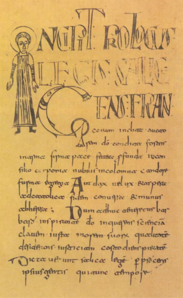
Schon das älteste fränkische Rechtsbuch, die „Lex Salica“, aus dem 5. Jahrhundert beschreibt die Einteilung des Frankenlandes in Gaue. Unsere Heimat gehörte zum Moselgau. Nachbargaue waren der Bitgau, Carosgau, Ardennengau, Nahegau, Saargau, Bliesgau usw.
Die Königsmacht der Merowinger schwand dahin, immer stärker aber wurde der Hausmeier, der Majordomus. Einem derselben, Pippin, gelang des schließlich 752 als erster Karolinger zum König der Franken ausgerufen zu werden. Unter seinem Sohn, Kaiser Karl dem Großen, erreichte das Frankenreich die größte Ausdehnung. Aber schon die Bürgerkriege seiner Söhne brachten wieder neues Unheil über das Land, das erst seinen Abschluss durch den Vertrag zu Verdun 843 fand, der die zukünftige Spaltung in Deutschland und Frankreich bedeutete. Im Jahr 870 wurde das Reich erneut im Vertrag zu Mersen ungefähr nach der heutigen Sprachgrenze aufgeteilt. Die fünf ripuarischen Gaue, dazu zählte auch der Moselgau, kamen zu Deutschland.
Im 12. Jahrhundert ging die alte Gauverfassung zu Ende, zahlreiche Adelsgeschlechter kamen auf und errichteten Burgen. Deren Anerkennung als Landesherren wurde 1231 auf dem Reichstag zu Worms ausgesprochen. Auch geistliche Herrschaften entstanden, und alle diese komplizierten Kleinherrschaften waren miteinander verzahnt bzw. standen gegeneinander oder verbündeten sich wechselseitig. Im Deutsche Reich gab es damals 300 Einzelstaaten, und diese „unhaltsamen Zustände“ wurden erst durch die Französische Revolution beendet.
Mit dem Christentum kamen zur Frankenzeit die klösterlichen und adeligen Grundbesitzer, und das Tal verwandelte sich in einen blühenden Garten: auf der Gerget (Herrengarten), im Mardeinerland (St. Martin Trier), auf dem Münichbösch (Busch der Mönche), im Härenecken (Herrenecke). Es muss schon ein begehrenswertes Fleckchen gewesen sein, das sie sich ausgesucht hatten. Im Jahre 966 schenkte Kaiser Otto I., der Große, seinen Hof in Wintrich der Abtei St. Maximin in Trier. 1098 bestätigte Kaiser Heinrich IV. dem Simeonsstift in Trier seinen Besitz in Wintrich (Simeonsberg). Die Landeshoheit gehörte dem Kurfürsten von Trier. Die Klöster bzw. Abteien von Klausen, St. Martin, Trier, Tholey, Mettlach, das Trierer Domkapitel, Himmerod, Kartause und St. Alban bei Trier hatten in Wintrich Besitztümer. Ebenso als weltliche Herren die Ritter von Neuerburg, die Grafen von Esch, Vianden und das Haus Oranien-Nassau, die Grafen von Salm, von Enschringen und die Vögte von Hunolstein, sie alle hatten in Wintrich Weingüter.
Die Pfarrkirche zum hl. Stephanus erscheint erstmals in dem Diplom vom 14. Januar 1340, in welchem der Trierer Erzbischof Balduin von Luxemburg die Inkorporation der Pfarrei Wintrich durch die Edelknechte Philipp und Johann von Weiskirchen vom 9. Dezember 1339 mit der Kartause bei Trier bestätigt. Von da ab war der Prior der Kartause der eigentliche Pfarrer von Wintrich. Zu seiner Vertretung bestellte er einen Vicarius perpetuus. Dieses Patronatsrecht hatte Bestand bis zur Französichen Revolution.
- Land und Leute hatten immer wieder unter Kriegswirren zu leiden:
- Dreißgjährige Krieg (1618–1648) 2.
- Raubkrieg Ludwig XIV. (1672–1678) 3.
- Raubkrieg Ludwig XIV. (1688–1697)
- Spanischer Erbfolgekrieg (1740–1748)
- Siebenjähriger Krieg (1756–1763)
Alle diese Kriege wurden auch bei uns ausgetragen und viele Chronisten berichten aus diesen mühseligen und leidvollen Tagen, in denen sich kein Wohlstand bilden konnte. 1794 kamen dann als Folge der Französichen Revolution die Franzosen. Im Vertrag zwischen Preußen und Frankreich vom 15.04.1795 fiel das linke Rheinufer an Frankreich. Nach einer vorläufigen Einteilung unterstand Wintrich der Mairie Lieser und Arrondissement Trier im Saardepartement.
Auf dem Wiener Kongreß wurde am 1.02.1815 die Rheinprovinz der Krone Preußens zugesprochen. Nach dem Vertrag vom 31.05.1815 wurde Wintrich dem Amte Mülheim eingegliedert. Der Staat Preußen bestand ab 1918 als Republik bis 1947.
- Geschichte, Kultur